This is an old revision of the document!
Table of Contents
Flight Recorder
Keep all important graphs on one view with export and replay functions including Google Earth export.
You can click on each of the graphs to show it maximized. Click on it again to revert it to normal size.
Airspeed
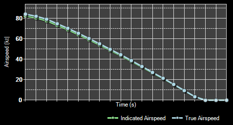
The first graph shows the current indicated and true airspeed.
Altitude
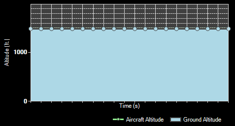
Here the aircraft altitude above mean sea level (MSL) as well as above ground is displayed.
Vertical Speed
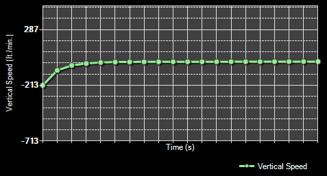
This graph shows the current vertical speed per minute.
Attitude
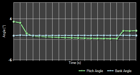
And finally here the aircraft attitude is shown as bank and pitch angle.
Recording and Playback

At the bottom left you will find the recording and playback controls.
You can start and stop the live recording of aircraft data at any time. While the recording is stop you can use the playback controls to go through the recorded data easily. If you want to delete all recorded data and start all over again use the button Clear All Flight Data.
Import and Export
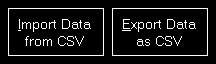
Additionally you can import and export the flight data from respectively to a CSV file.
Print Charts

You can also print the displayed charts by clicking on the Print Charts button.
Export to Google Earth

Also an export to Google Earth is possible.
You can even choose if VORs, NDBs or waypoints should be exported as place marks additionally.
 Note: The range around the flight path where VORs, NDBs and waypoints are included can be adjusted in the Settings module.
After pressing the button Export to Google Earth you can directly start Google Earth with the exported data as long as Google Earth is installed on the current computer.
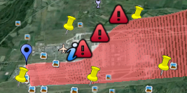
Here you can see how your flight data will look like then when it is shown in Google Earth.
Settings
Flight Recorder
These settings are related to the Landing Analysis module.
Color Settings
In this area you can customize all colors used to draw the statistics graphs.
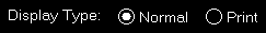
All colors can be defined per display type.
Therefore please first select if you want to change the colors for the normal in program display or for printout.
Revert to Defaults

You can easily revert all colors to their defaults by using the Revert to Defaults button.
Colors for Display Type
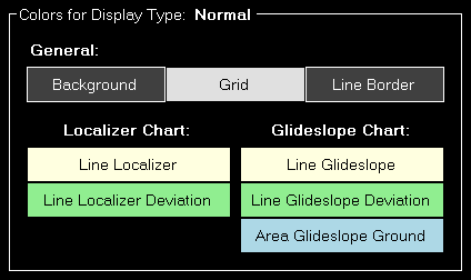
Here all currently defined colors are displayed for the selected display type.
Click on any of the button to select a different color.
Print Options
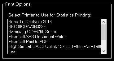
For statistics printing you can define here which printer should be used.
Aircraft Warnings
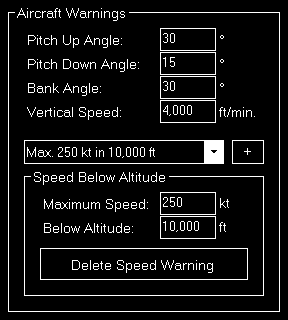
Here you can set limits for some parameters like pitch or bank angle for the aircraft.
Speed Below Altitude
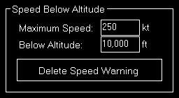
Additionally you can define maximum speeds below certain altitudes above mean sea level (MSL).
These settings are used to show warning indicators when exporting graph data to Google Earth.
Google Earth Export
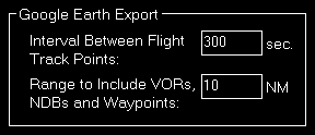
Define all Google Earth export related settings in this area.
Every certain time interval a flight track point is shown in Google Earth with detailed flight information. You can set this time interval here.
Additionally you can define the range for including VORs, NDBs and waypoints if their export is enabled.